


Drones
Agriculture is confronted with major challenges today and in the future. On the one hand, more and more people have to be fed using existing arable land. Thus, existing arable land must be managed more efficiently. On the other hand, agriculture must adapt to climate change and the constantly changing framework conditions.
One promising approach is the use of intelligent drones. Equipped with spraying systems, communication modules, camera technology, grippers and many other technologies, drones are able to detect pest problems, optimise irrigation, detect disease infestation of plants or even identify soil problems and fertiliser problems. Farmers can thus save a lot of time.
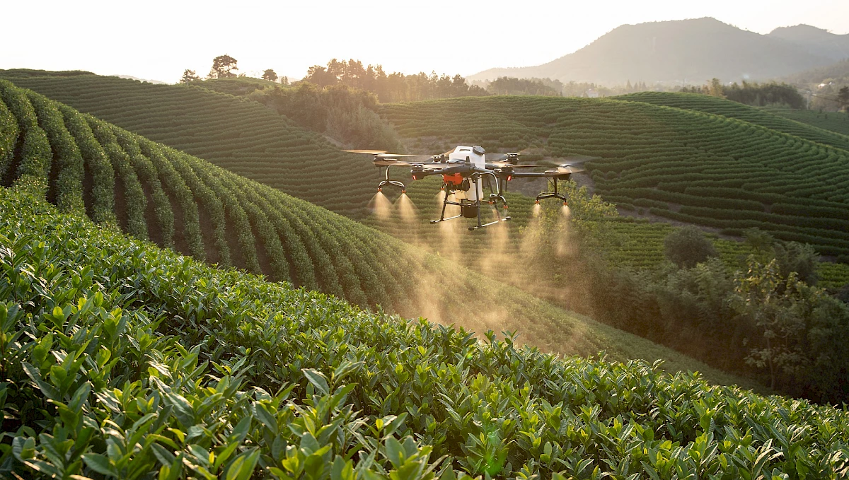 A drone sprays targeted pesticides on plants identified as diseased.
© https://pixabay.com/de/photos/dji-drohne-pflanzenschutz-drohne-5331570/
On the one hand, the drone collects data, for example from a mounted camera. This data can then be analysed in a matter of seconds using machine learning algorithms (computer vision) so that, for example, plant diseases can be visually displayed on a map. On the other hand, since drones have other technologies, such as GPS and spraying systems, the drone can also treat the diseased plants directly. This means that the whole field no longer has to be treated provisionally. Of course, this also benefits nature, as fewer pesticides need to be used.
Drones are therefore a very suitable working tool for farmers, as they help to make the farm more sustainable and productive.
Areas of application
- Progress measurement and monitoring
- Field management
- Precision farming
- Soil science
- Pest control
- Crop protection
- Wildlife rescue
- Planning and mapping water drainages
- Documenting stock
- Identify diseases in the stand
- Optimise irrigation of the area
- Identify the optimal time for harvesting
- Improve the use of crop protection products
Prerequisite for use
In order to operate drones commercially in the civilian sector, a general ascent permit must be obtained for the federal state. It is easier to meet the requirements of personal rights, data protection and safety if the areas flown over are privately owned. Drone liability insurance is required in the event of damage. Proof of a drone operator's licence is also required. Furthermore, the drone must be registered to the user.
In order to be able to evaluate the data of the drones, an IT infrastructure is required. You can set this up yourself or use external service providers.
Further information can be found on the website of the Münster district government
https://www.bezreg-muenster.de/de/verkehr/drohnen/index.html